Thunder Bay Power Company (TBPC) is a hydroelectric company located
in Alpena, MI. This company was formed in 1989. TBPC owns and operates
four hydroelectric dams and two water storage dams in the Thunder
Bay River Basin. The Federal Energy Regulatory Commission reissued
a license for generation to TBPC on December 11, 1998.
The purpose of this website is to provide a means of compliance monitoring
to the state and federal agencies according to License Articles 401
and 402. TBPC has just completed the second year of a two-year testing
period of various types of monitoring. For more information about
the license articles that pertain to water quality, go to the Articles
page.
To view a map of our dam locations
please click here.
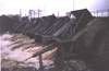
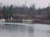
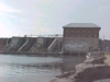
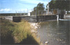
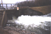
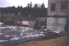
Please click on one of the thumbnails below to view the appropriate
picture gallery.
Ninth Street Development
 The Ninth Street Development includes: (1) an existing reservoir with
a surface area of 700 acres and a total storage volume of 6,000 acre-feet
at the normal maximum surface elevation of 598.25 feet National Geodetic
Vertical Datum (NGVD); (2) an existing retaining wall, 6 feet high
by 285 feet long; (3) an existing buttressed retaining wall, 145 feet
long; (4) an existing abandoned fishway; (5) an existing concrete
uncontrolled spillway section, 47 feet long; (6) an existing gated
spillway section, 131 feet long, containing seven taintor gates, each
14 feet long by 12 feet high; (7) an existing concrete gravity non-overflow
system, 47 feet long; (8) an existing reinforced concrete and masonry
powerhouse, 92 feet long by 84 feet wide, containing (a) three horizontal
shaft Sampson runner turbines with a combined maximum plant hydraulic
capacity of 1,520 cubic feet per second (cfs), manufactured by the
James Leffel Company and rated at 600 horsepower (hp) each, and (b)
three General Electirc generators, each rated at 400 kW, providing
a total plant rating of 1,200 kW; (9) an existing reinforced concrete
non-overflow section (a retaining wall about 20 feet long); and (10)
existing appurtenant facilities.
The Ninth Street Development includes: (1) an existing reservoir with
a surface area of 700 acres and a total storage volume of 6,000 acre-feet
at the normal maximum surface elevation of 598.25 feet National Geodetic
Vertical Datum (NGVD); (2) an existing retaining wall, 6 feet high
by 285 feet long; (3) an existing buttressed retaining wall, 145 feet
long; (4) an existing abandoned fishway; (5) an existing concrete
uncontrolled spillway section, 47 feet long; (6) an existing gated
spillway section, 131 feet long, containing seven taintor gates, each
14 feet long by 12 feet high; (7) an existing concrete gravity non-overflow
system, 47 feet long; (8) an existing reinforced concrete and masonry
powerhouse, 92 feet long by 84 feet wide, containing (a) three horizontal
shaft Sampson runner turbines with a combined maximum plant hydraulic
capacity of 1,520 cubic feet per second (cfs), manufactured by the
James Leffel Company and rated at 600 horsepower (hp) each, and (b)
three General Electirc generators, each rated at 400 kW, providing
a total plant rating of 1,200 kW; (9) an existing reinforced concrete
non-overflow section (a retaining wall about 20 feet long); and (10)
existing appurtenant facilities.
Four Mile Development
 The Four Mile Development includes: (1) an existing reservoir with
a surface area of 90 acres and a total storage capacity of 900 acre-feet
at the normal maximum surface elevation of 634.35 feet NGVD; (2) an
existing concrete ogee spillway (constructed immediately downstream
from the original rock filled timber dam), 455 feet long, topped by
neadle beams, containing: (a) a log shute bay, and (b) an abandoned
fishway bay; (3) an existing concrete and masonry powerhouse, 72 feet
by 72 feet containing: (a) a concrete forebay, (b) three existing
horizontal shaft Sampson runner turbines with a combined maximum hydraulic
capacity of 1,600 cfs, rated at 850 hp each, (c) three existing General
Electric generators, each rated at 600 kW, (d) a proposed Flygt Corporation
turbine with a maximum hydraulic cpacity of 295 cfs (providing a proposed
maximum plant hydraulic capacity of 1,895 cfs), and (e) a proposed
Flygt Corporation generator, rated at 600 kW (providing a total proposed
plant rating of 2,400 kW); and (4) existing appurtenant facilities.
The Four Mile Development includes: (1) an existing reservoir with
a surface area of 90 acres and a total storage capacity of 900 acre-feet
at the normal maximum surface elevation of 634.35 feet NGVD; (2) an
existing concrete ogee spillway (constructed immediately downstream
from the original rock filled timber dam), 455 feet long, topped by
neadle beams, containing: (a) a log shute bay, and (b) an abandoned
fishway bay; (3) an existing concrete and masonry powerhouse, 72 feet
by 72 feet containing: (a) a concrete forebay, (b) three existing
horizontal shaft Sampson runner turbines with a combined maximum hydraulic
capacity of 1,600 cfs, rated at 850 hp each, (c) three existing General
Electric generators, each rated at 600 kW, (d) a proposed Flygt Corporation
turbine with a maximum hydraulic cpacity of 295 cfs (providing a proposed
maximum plant hydraulic capacity of 1,895 cfs), and (e) a proposed
Flygt Corporation generator, rated at 600 kW (providing a total proposed
plant rating of 2,400 kW); and (4) existing appurtenant facilities.
Norway Point Development
 The Norway Point Development includes: (1) an existing reservoir with
a surface area of 1,700 acres and a total storage volume of 27,550
acre-feet at the normal maximum surface elevation of 670.7 feet NGVD;
(2) an existing earth embankment, about 500 feet long; (3) an existing
mass concrete multiple barrel arch spillway with removable needle
beams, 320 feet long, containing eight barrel arch selections, each
40 feet long; (4) an existing beartrap gate section, 120 feet long,
containing three beartrap gates, each 26 feet long by 27 feet high;
(5) an existing abandoned fishway; (6) an existing reinforced concrete
and masonry powerhouse, 86 feet long by 49 feet wide, containing:
(a) two vertical shaft Francis turbines with a combined maximum hydraulic
capacity of 1,675 cfs, the first manufactured by Wellman-Seaver-Morgan
Company and rated at 3,350 hp and the second rated at 1,400 hp, and
(b) two General Electric generators, rated at 2,800 kW and 1,200 kW,
providing a total plant rating of 4,000 kW; (7) an existing earth
dike, about 1,460 feet long; and (8) existing appurtenant facilities.
The Norway Point Development includes: (1) an existing reservoir with
a surface area of 1,700 acres and a total storage volume of 27,550
acre-feet at the normal maximum surface elevation of 670.7 feet NGVD;
(2) an existing earth embankment, about 500 feet long; (3) an existing
mass concrete multiple barrel arch spillway with removable needle
beams, 320 feet long, containing eight barrel arch selections, each
40 feet long; (4) an existing beartrap gate section, 120 feet long,
containing three beartrap gates, each 26 feet long by 27 feet high;
(5) an existing abandoned fishway; (6) an existing reinforced concrete
and masonry powerhouse, 86 feet long by 49 feet wide, containing:
(a) two vertical shaft Francis turbines with a combined maximum hydraulic
capacity of 1,675 cfs, the first manufactured by Wellman-Seaver-Morgan
Company and rated at 3,350 hp and the second rated at 1,400 hp, and
(b) two General Electric generators, rated at 2,800 kW and 1,200 kW,
providing a total plant rating of 4,000 kW; (7) an existing earth
dike, about 1,460 feet long; and (8) existing appurtenant facilities.
Hubbard Lake Development
 The Hubbard Lake Development includes: (1) an existing reservoir with
a surface area of 9,280 acres and a total storage volume of 57,000
acre-feet at the surface elevation of 709.6 feet NGVD; (2) an existing
earth embankment section with concrete retaining walls along the upstream
and downstream faces, 70 feet and 49 feet long, respectively; (3)
an existing reinforced concrete spillway section, 20 feet long, containing
two needle beam controlled bays; (4) an existing earth embankment
section with concrete retaining walls along the upstream and downstream
faces, 55 feet and 51 feet long, respectively; and (5) existing appurtment
facilities.
The Hubbard Lake Development includes: (1) an existing reservoir with
a surface area of 9,280 acres and a total storage volume of 57,000
acre-feet at the surface elevation of 709.6 feet NGVD; (2) an existing
earth embankment section with concrete retaining walls along the upstream
and downstream faces, 70 feet and 49 feet long, respectively; (3)
an existing reinforced concrete spillway section, 20 feet long, containing
two needle beam controlled bays; (4) an existing earth embankment
section with concrete retaining walls along the upstream and downstream
faces, 55 feet and 51 feet long, respectively; and (5) existing appurtment
facilities.
Upper South Development
 The Upper South Development includes: (1) an existing reservoir with
a surface area of 7,000 acres and a total storage volume of 55,000
acre-feet at the normal maximum surface elevation of 731.0 feet NGVD;
(2) an existing earth embankment section, about 40 feet long; (3)
an existing reinforced concrete spillway section, 40 feet long, containing:
(a) four needle beam controlled bays, each 8 feet wide, and downstream
ends at both spillway abutments; (4) an existing earth embankment
section, about 250 feet long; and (5) existing appurtenant facilities.
The Upper South Development includes: (1) an existing reservoir with
a surface area of 7,000 acres and a total storage volume of 55,000
acre-feet at the normal maximum surface elevation of 731.0 feet NGVD;
(2) an existing earth embankment section, about 40 feet long; (3)
an existing reinforced concrete spillway section, 40 feet long, containing:
(a) four needle beam controlled bays, each 8 feet wide, and downstream
ends at both spillway abutments; (4) an existing earth embankment
section, about 250 feet long; and (5) existing appurtenant facilities.
Hillman Development
 The Hillman Development includes: (1) an existing reservoir with a
surface area of 160 acres and a total storage reservoir with a surface
area of 160 acres and a total storage volume of 500 acre-feet at the
normal maximum surface elevation of 746.85 feet NGVD; (2) an existing
earth fill section, about 50 feet long, with a concrete retaining
wall along the upstream face, extending 35 feet from the gated spillway
abutment; (3) an existing concrete gated spillway section, approximately
38 feet long, containing: (a) three needle beam controlled bays, each
about 11 feet long, and (b) a reinforced concrete apron, constructed
along the downstream toe of the spillway; (4) an existing non-overflow
section, 26 feet long, consisting of upstream and downstream concrete
gravity walls with pressure grouted earth and rock fill between the
two walls; (5) an existing concrete uncontrolled spillway section,
27 feet long, (formerly the intake structure of the grist mill in
the early 1900's); (6) an existing non-overflow section, 20 feet long,
consisting of upstream and downstream concrete gravity walls with
pressure grouted earth and rock fill between the two walls; (7) an
existing reinforced conrete and masonry powerhouse, 17 feet by 21
feet, containing (a) a vertical shaft Francis turbine with a maximum
hydraulic capacity of 270 cfs, manufactured by the James Leffel Company,
and (b) a vertical shaft generator, manufactured by Westinghouse and
rated at 250 kW; and (8) existing appurtenant facilities.
The Hillman Development includes: (1) an existing reservoir with a
surface area of 160 acres and a total storage reservoir with a surface
area of 160 acres and a total storage volume of 500 acre-feet at the
normal maximum surface elevation of 746.85 feet NGVD; (2) an existing
earth fill section, about 50 feet long, with a concrete retaining
wall along the upstream face, extending 35 feet from the gated spillway
abutment; (3) an existing concrete gated spillway section, approximately
38 feet long, containing: (a) three needle beam controlled bays, each
about 11 feet long, and (b) a reinforced concrete apron, constructed
along the downstream toe of the spillway; (4) an existing non-overflow
section, 26 feet long, consisting of upstream and downstream concrete
gravity walls with pressure grouted earth and rock fill between the
two walls; (5) an existing concrete uncontrolled spillway section,
27 feet long, (formerly the intake structure of the grist mill in
the early 1900's); (6) an existing non-overflow section, 20 feet long,
consisting of upstream and downstream concrete gravity walls with
pressure grouted earth and rock fill between the two walls; (7) an
existing reinforced conrete and masonry powerhouse, 17 feet by 21
feet, containing (a) a vertical shaft Francis turbine with a maximum
hydraulic capacity of 270 cfs, manufactured by the James Leffel Company,
and (b) a vertical shaft generator, manufactured by Westinghouse and
rated at 250 kW; and (8) existing appurtenant facilities.